Objective:
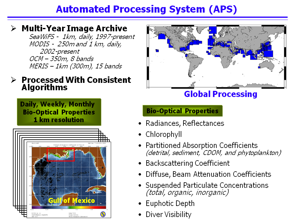
The satellite Automated Processing System (APS) has been under development at NRL/SSC since the early 1990¿s. Originally developed to process CZCS imagery, it has continually evolved to add new capabilities to process additional sensors, including AVHRR, SeaWiFS, MODIS, OCM, MERIS, and HICO (NRL¿s new hyperspectral sensor aboard the International Space Station). APS is a collection of UNIX programs and shell scripts designed to generate regional map-projected image data bases of satellite derived bio-optical products from a large flow of raw satellite input data in an automated fashion. It is consistent with NASA processing code (SeaDAS 6.1) for SeaWiFS, MODIS, MERIS, but with the addition of Navy-specific algorithms and products (absorption, backscattering coefficients, diver visibility). It has been ported to multiple platforms (Linux RH 7.1/7.3, SGI IRIX 6.5) and has been transitioned to the Naval Oceanographic Office and NOAA. APS is a complete end-to-end processing system, performing radiometric, atmospheric, geometric corrections, and application of bio-optical algorithms within several minutes of data reception. In addition to the daily scenes, data are processed into several temporal (8-day, monthly, yearly) composites. An SQL database is automatically populated during image processing to allow web browsing of the bio-optical properties. APS handles multiple input streams of both real-time and archival global data, from NOAA and NASA, as well as from the receiving system located at NRL/SSC. APS undergoes continuous upgrades to add new sensors and algorithms. With the system architecture in place, it is straightforward and simple to add new processing areas and to reprocess large data bases when new algorithms/processing versions become available.
APS Documentation