United States Naval Research Laboratory
Bio-Optical/Physical Processes and Remote Sensing Section
Satellite Ocean Color Remote Sensing and Hydrodynamic Modeling to Understand Hypoxia in the Northern Gulf of Mexico
Objective:
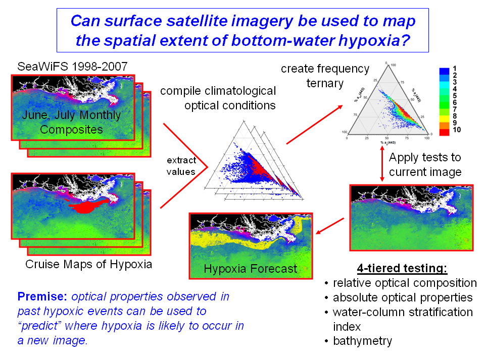
The frequency, extent, and severity of coastal hypoxic events are increasing worldwide due to increasing eutrophication. Hypoxia occurs when water column oxygen levels drop below 2 mg/l, and these low oxygen levels can potentially impact local fisheries and benthic organisms, with important ecological and economic consequences. This "dead zone" off the coast of Louisiana forms every year summer and is the second largest hypoxic zone in the world. We combine a satellite-derived optical water mass classification technique with a model-derived stratification index to estimate the areal extent of coastal hypoxia in the northern Gulf of Mexico. The premise is that by comparing current optical conditions to those observed during the past hypoxic events, we can "predict" where hypoxia is most likely to occur. In addition, NRL is working closely with the EPA Gulf Breeze Laboratory to develop a coupled hydrodynamic and biogeochemical model for the northern Gulf of Mexico hypoxia region. We are integrating satellite ocean color remote sensing imagery, hydrodynamic-water quality-sediment diagenesis modeling, and in situ measurements to assess and predict coastal ocean processes (such as nutrient-enhanced primary production) that regulate the development and size of hypoxic bottom waters in the region. We will operate the coupled models in hindcast mode to estimate the size and extent of past hypoxic events. We will also apply change scenarios to estimate the impact of possible environmental/climate change (river discharge, nutrient loads) on the size, extent, and duration of the hypoxic zone.