United States Naval Research Laboratory
Bio-Optical/Physical Processes and Remote Sensing Section
High-Resolution Subsurface Physical and Optical Property Fields in the Gulf of Mexico: Establishing Baselines and Assessment Tools for Resource Managers
Objective:
We propose to provide a database of subsurface physical and optical property fields for specific local areas within the Gulf of Mexico using a blend of data assimilative ocean modeling tools and ocean color remote sensing products. These three-dimensional property fields are needed to inform the decision-making process of resource managers, with particular emphasis on (i) habitat identification and characterization, (ii) assessment of the environmental impact of various permitted activities, such as dredging, and (iii) water quality assessment.
Accordingly, we have identified two specific decision-making processes within the Gulf of Mexico that will be aided by the establishment of our proposed database. First, the Flower Garden Banks National Marine Sanctuary (FGBNMS) works with the Sanctuary Advisory Council, constituents, and users to conduct periodic management reviews of current regulations. The FGBNMS is currently going through a review, and potential boundary expansion has been identified as a priority management issue. The boundary expansion proposals and deliberations would be significantly aided by knowledge of baseline environmental conditions, such as light, temperature, and salinity, for benthic biological communities that may be ecologically linked to the presently protected areas. Second, the natural variability of coastal turbidity (suspended sediment load) is not known for local areas where the United States Army Corps of Engineers (USACE) are required to monitor during their dredging, flood protection, and coastal restoration activities. Knowledge of this natural variability would provide a baseline against which data from their monitoring activities may be assessed.
With the expressed support of FGBNMS-NOAA and USACE, we will provide high-resolution and three-dimensional light, temperature, salinity, and current field estimates, and surface maps of suspended sediment load, made from a combination of satellite remote sensing and ocean modeling. By providing both a regional context and local-scale details, these products will help resource managers make more informed decisions.
Image Climatology (2005-2009) Northern Gulf of Mexico Bays
Satellite-Extracted Data Files
Satellite Bio-Optics Project Summary Report
Satellite-Extracted Data Files
Satellite Bio-Optics Project Summary Report
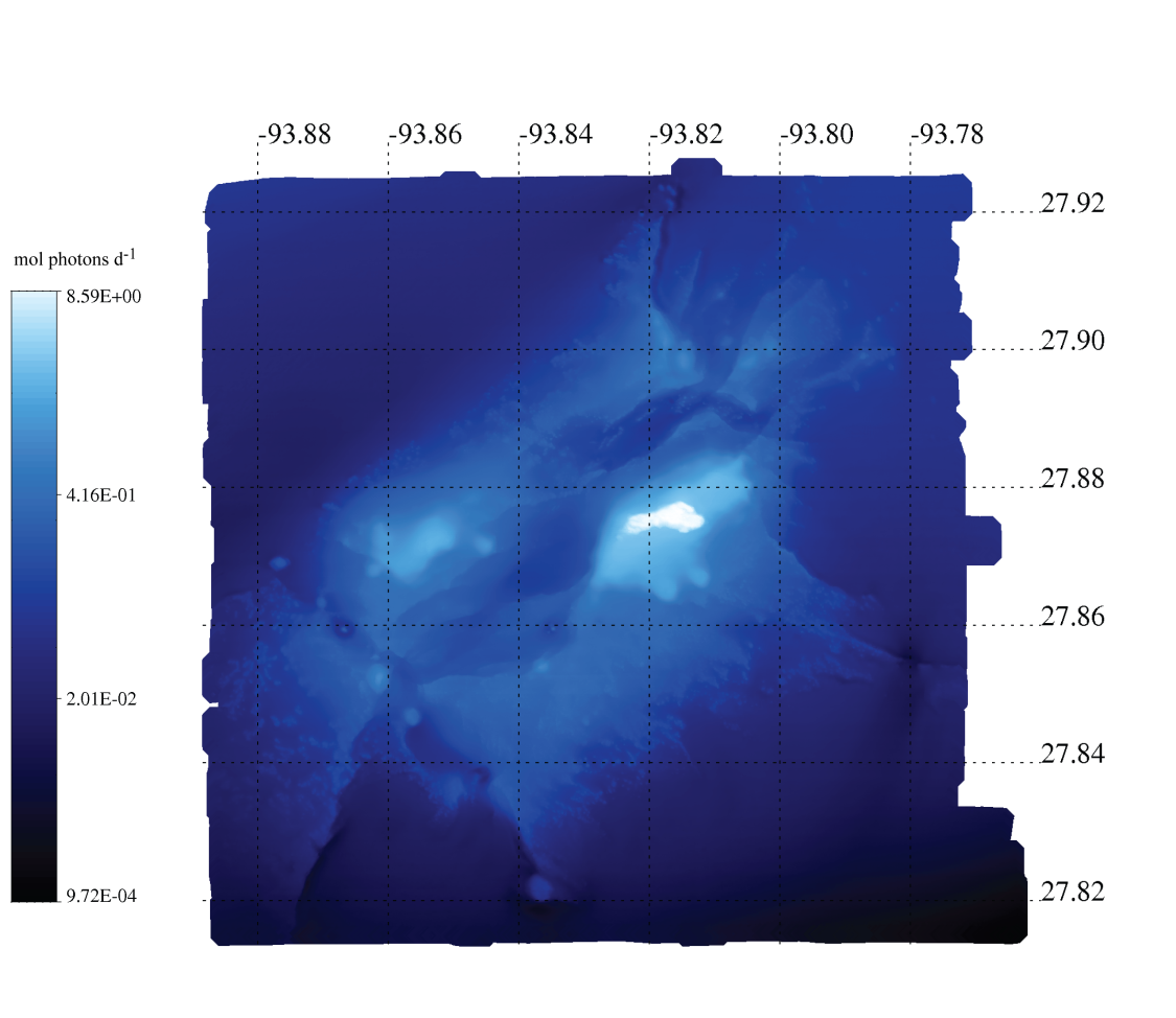
Mean Bottom Photon Flux, West Flower Garden Bank
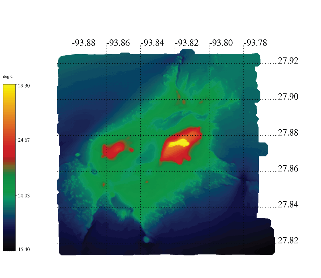
Mean Jul-Aug-Sep Bottom Temperatures, West Flower Garden Bank
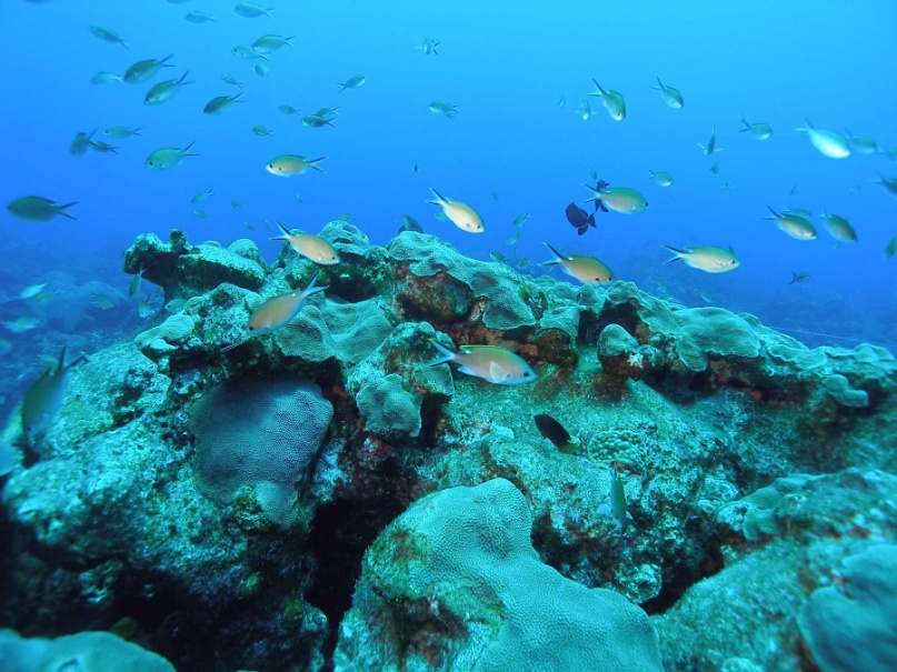
Flower Garden Banks National Marine Sanctuary (Image Courtesy NOAA-FGBNMS)