United States Naval Research Laboratory
Bio-Optical/Physical Processes and Remote Sensing Section
Transformational approach to monitoring water quality sustainability of coastal ecosystems from satellite remote sensing
Objective:
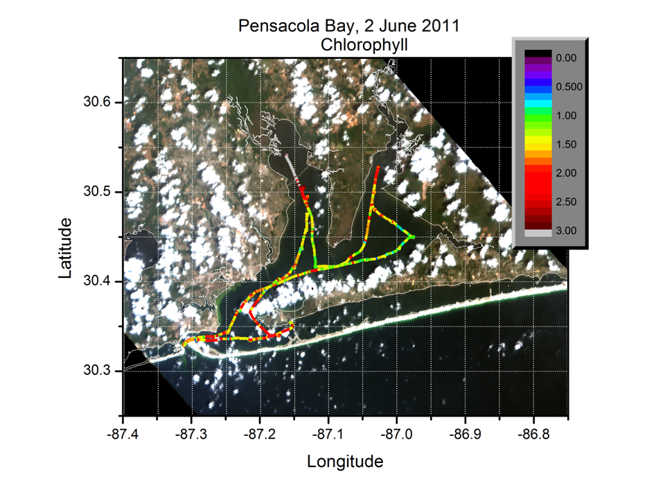
The primary objective of this project is to develop a novel space-based environmental monitoring system that provides water quality products and information appropriate for the sustainable management of coastal ecosystems. This project is an innovative use of the Hyperspectral Imager for the Coastal Ocean (HICO), an NRL sensor operating on the International Space Station, to monitor coastal systems across a range of spatial and temporal scales not currently feasible. This novel proof-of-concept project will field validate the HICO remote sensing data using small boat surveys in estuaries and autonomous underwater vehicles (gliders) in adjacent coastal waters. Results from this initial, proof-of-concept test will assist in sensor and algorithm calibration/validation efforts and will hopefully lead to a future launch of a high-resolution, hyperspectral, satellite-based sensor for monitoring coastal systems. Such a system would increase publically available water quality data in the future (i.e., making it as common and readily available as weather data). NRL and EPA scientists are collaborating on this project. The second objective is to provide the foundation for a technology, which EPA can use in the future to report water quality conditions nationwide through media outlets and Smartphone applications.